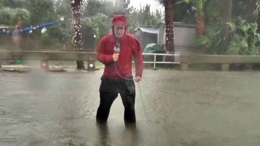
People from the Florida Panhandle down to the Tampa area braced Thursday for Hurricane Hermine, as it lashes the area with strong winds and potentially dangerous storm surge.
The National Hurricane Center said the storm's winds ratched up from 75 mph in the afternoon to 80 mph by evening as the former tropical storm gained new fury.
Hermine was set to make landfall late Thursday or early Friday, forecasters said. A hurricane warning was in effect for Florida's Big Bend from the Suwannee River to Mexico Beach. And on the East Coast, a tropical storm warning was issued for an area that extended from Marineland, Florida, northward to the South Santee River in South Carolina.
Hermine marked part of a one-two punch of severe storms hitting the U.S. as Tropical Storm Madeline pummeled shorelines of Hawaii's Big Island. The storm was downgraded from hurricane strength on Wednesday but still packed winds reaching 50 mph on Thursday as it passed by the island.
If Hermine continues to maintain hurricane strength by the time it makes landfall, it would be the first hurricane to slam Florida since Wilma in 2005. Tens of thousands of people could be in Hermine's path as it moves northeast.
Forecasters warned Hermine could pack wind gusts topping 80mph with storm surge reaching 7 feet. The storm is likely to be felt the strongest across the Big Bend of Florida, which is relatively less populated than points west and inland.
Florida Gov. Rick Scott warned of the danger of strong storm surge, high winds, downed trees and power outages, and he urged people to move to inland shelters if necessary and make sure they have enough food, water and medicine.
"This is a life-threatening situation," Scott said. "It's going to be a lot of risk. Right now, I want everybody to be safe."
The storm also could unleash more than a foot of rain across much of Central and North Florida as well as isolated tornadoes across North Florida into southern Georgia.
Georgia's governor declared a state of emergency for 56 counties through Saturday, in anticipation of high water and strong winds.
The National Guard on Thursday activated 100 troops to help first responders in Florida. 6,000 additional troops were on alert.
Hermine's maximum sustained winds Thursday evening were near 80 mph. Some additional strengthening was forecast and the U.S. National Hurricane Center said Hermine was likely to be a Category 1 hurricane when it makes landfall in Florida on Thursday night or early Friday.
As of 8 p.m. EDT, Hermine was in the Gulf of Mexico, centered about 45 miles south of Apalachicola, Florida, and was moving north-northeast at about 14 mph.
Residents in some low-lying communities in Florida were being asked to evacuate Thursday as the storm approached. The Tallahassee Democrat reported that emergency management officials in Franklin County have issued a mandatory evacuation notice for people living on St. George Island, Dog Island, Alligator Point and Bald Point. Residents in other low-lying areas prone to flooding were also being asked to evacuate.
Scott ordered state government offices in 51 counties to close at noon Thursday. The order included the state capital of Tallahassee, home to tens of thousands of state workers. The city, which is located roughly 35 miles from the coast, has not had a direct hit by hurricane in 30 years.
Residents were out in force Thursday morning preparing for the storm and stores were already running low on bottled water and flashlights. City crews were struggling to keep up with demand for sand with sandbags.
People in the Big Bend area were getting ready for possible storm surge and heavy rain. In Cedar Key, Jordan Keeton said workers started placing sandbags Wednesday to protect his 83 West restaurant from possible flooding. He said he was mostly worried about the new equipment he'd recently purchased for the waterfront restaurant.
"This building right here is pretty safe and pretty strong so I think it will be all right," Keeton said. "Pretty much the new equipment is my primary concern."
Flooding is expected across a wide swath of the Big Bend area, which has a mostly marshy coastline. Florida's Big Bend area extends from just east of the Apalachicola River in the Panhandle to roughly the Cedar Key area, which is west of Gainesville. It is made up of mostly rural communities and smaller cities off the beaten paths of Interstate 10 and Interstate 75.
In South Carolina, Friday night lights will be Thursday night lights in many areas. News outlets reported that high school football games in many areas will be played Thursday night because Hermine was expected to bring heavy rains to the state Friday.
In Charleston County, emergency officials have a message for residents: Stay home on Friday. The storm is expected to flood streets in the Charleston area which can see high tide flooding even on sunny days.
Fox News' Lucas Tomlinson and The Associated Press contributed to this report.


